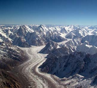
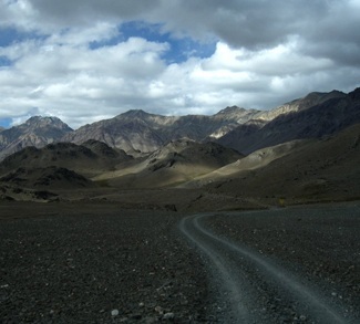
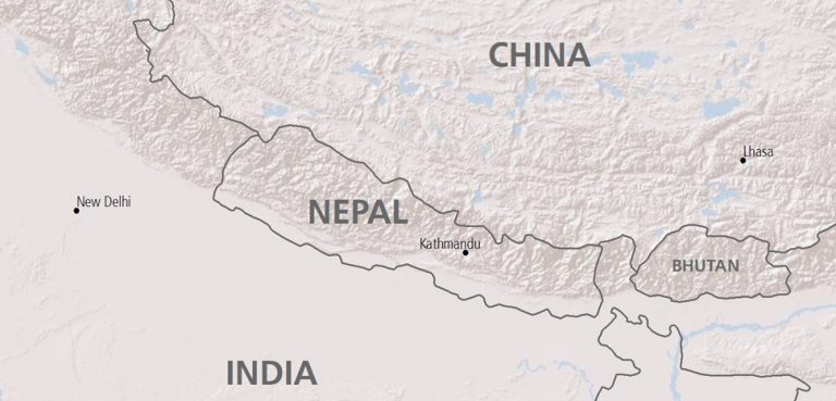
The Karakoram Range lies on the northernmost borders of Pakistan and India, further extending into the western border of China. The range houses a huge concentration of peaks over 8,000 meters in height, including K2, the world’s second-highest peak. It consists of the Ladakh region of India, the Gilgit-Baltistan region of Pakistan Occupied Kashmir, and it touches the Aksai Chin region occupied by China.
The post Second World War era, when India was partitioned and China saw a Communist takeover, brought the region into the limelight. Immediately after its inception, Pakistan occupied the Gilgit-Baltistan region. To find a solution to the conflict, then Prime Minister Nehru appealed to the UN, which facilitated the establishment of a ceasefire line in 1949. The ceasefire agreement gave a vague border demarcation in the high reaches of Karakoram, as it consisted of uninhabitable terrain. This ambiguity led to Operation Meghdoot by the Indian Army in 1984 to capture the Siachen glacier, which added another dimension to the Kashmir conflict. Since the northern borders of Siachen touch China, the glacier is the world’s only trilateral border junction of three nuclear powers.
In 1999, India and Pakistan fought a war in Kargil, which also lies in the Karakoram region. The Pakistani army occupied strategic peaks lying in Indian territory overlooking the Leh-Srinagar highway. The control over these peaks threatened to disconnect the Ladakh region from rest of Kashmir. In the end, the Indian Army was successful in recapturing these peaks.
With regard to China, the dispute started in Eastern Karakoram over the conflicting demarcation of the Aksai Chin region which led to the Sino-Indian war of 1962, following which China occupied Aksai Chin. The Aksai Chin contains the ‘western highway’ which links Xinjiang to Tibet and hence is supreme to China’s strategic interests.
The dispute over the Karakorams can be summarized as follows:
- Pakistani occupation of Kashmir in 1947, through which Gilgit-Baltistan came under Pakistani control.
- The war between India and China in 1962, which resulted in the China’s occupation of Aksai Chin.
- The China-Pakistan boundary agreement in 1963, which demarcated borders of both nations in the Karakoram region and the subsequent cession of the trans-Karakoram tract by Pakistan to China.
- The construction of the Karakoram Highway (beginning in 1967), which links Pakistan to China. This was the starting point of strategic cooperation between China and Pakistan.
- The dispute over the Siachen glacier, which led to the Indian Army capturing the glacier in 1984.
- The Kargil crisis of 1999.
The Karakoram Highway: Heart of the Sino-Pak Geopolitical Alliance
India’s border disputes with both Pakistan and China in the Karakoram region brought the latter two nations together and their alliance manifested in the form of the construction of Karakoram Highway in the 1960s, which is the sole overland link between Pakistan and China through the Gilgit-Baltistan region. India still claims Gilgit-Baltistan as a part of Kashmiri territory occupied by Pakistan.
Recently, Sino-Pak ties reached a new high when China signed a $46 billion deal with Pakistan to construct the China Pakistan Economic Corridor (CPEC), a southward extension of China’s Silk Road economic belt initiative, which will extend the highway southwards to Pakistan’s port city of Gwadar in Balochistan. The CPEC will drastically shorten the tedious maritime route which China currently uses. Under the present maritime route, ships destined for China have to pass through the waters surrounding the Indian Peninsula and the US Navy-controlled Malacca straits before docking in Chinese ports. With the completion of CPEC, imports will be docked at Gwadar port, From Gwardar, these goods will be transported via the Karakoram highway to China. This circumvention of lengthy trade route is not only aimed at cutting on transportation costs, but also has a strategic dimension as any possible threat from India or US naval presence will be evaded once the Gwadar port is connected to the Karakoram Highway.
Roots of Contested Geopolitics: The Great Game
To understand the complexity of the Karakorams, it is essential to take a larger picture of the legacy of the ‘Great Game’, which was a 19th century scramble for Central Asian territory between Great Britain and Russia. The period was marked with both the countries sending their army and spy expeditions to map this hitherto un-mapped region. The whole of 19th century was characterized by a constant suspicion of the Russians attempting to invade British India from her northwestern frontiers. Much of this apprehension of a Russian invasion of British India led to the drawing of present-day India’s northernmost frontiers.
Rapid Russian conquests of Central Asian Khanates (kingdoms) brought the Russians close to the northern fringes of the Karakoram Mountains, that is, in the Pamir Mountains (Present day Tajikistan). Also, Russia’s commercial dealings with Kashgar (now in Xinjiang, was a famous city of the Leh-Yarkand-Kashgar silk route) too made the British anxious of a possible Russian infiltration from Xinjiang.
By late 19th century, the British became more active in attempting to cartographically demarcate India’s northern frontiers. In this period, the Afghan frontier was drawn (the Durand Line) and the northern expansion of the Maharaja of Kashmir’s territories took place. Efforts were also made to negotiate with the Chinese and Russians. The Russians came to the bargaining table and negotiated boundary agreements and buffer regions but the Chinese on the other hand didn’t cooperate.
The Great Game ended long ago, but the era of suspicion, border disputes, and geopolitical calculations it propagated got carried into the post-colonial states of India, China, and Pakistan. These machinations of the Great Game got reproduced on the smaller canvas of the Karakoram mountain ranges. The obsession with borders and strategic mountain passes still characterizes the Karakoram region. India as a mutual enemy strengthened Chinese and Pakistani relations through the Karakoram highway and an unconditional border agreement. On the other hand, the Indian side Karakoram’s borders of Ladakh with Baltistan and Aksai Chin are heavily militarized.
The Karakorams have a glorious past as a Silk Route road connecting India to the markets of Central Asia. The region is also characterized by the rich cultural intermingling of Kashmiri, Turkic, and Buddhist culture through the trading caravans. Once India’s historical gateway to Central Asia and China, in the modern era it has become a lingering geopolitical flashpoint between India, China and Pakistan.


